Monday 29 January 2024

Crosscutsaw SNS Spur Mt Buggery -Howitt January 2024


With the long weekend fast approaching was getting an itch to get out for a hike forecast was warming up a little too much for my liking but figure its always cooler on the high plains.
With a false start on Friday I had a bad sleep so decided to go on Saturday instead and extend it to two nights until Monday.
Headed up around 8ish from Melbourne to Upper Howqua Camp Ground start of the trailhead.
On arrival the place was heaving with car campers enjoying the mini break by the river.
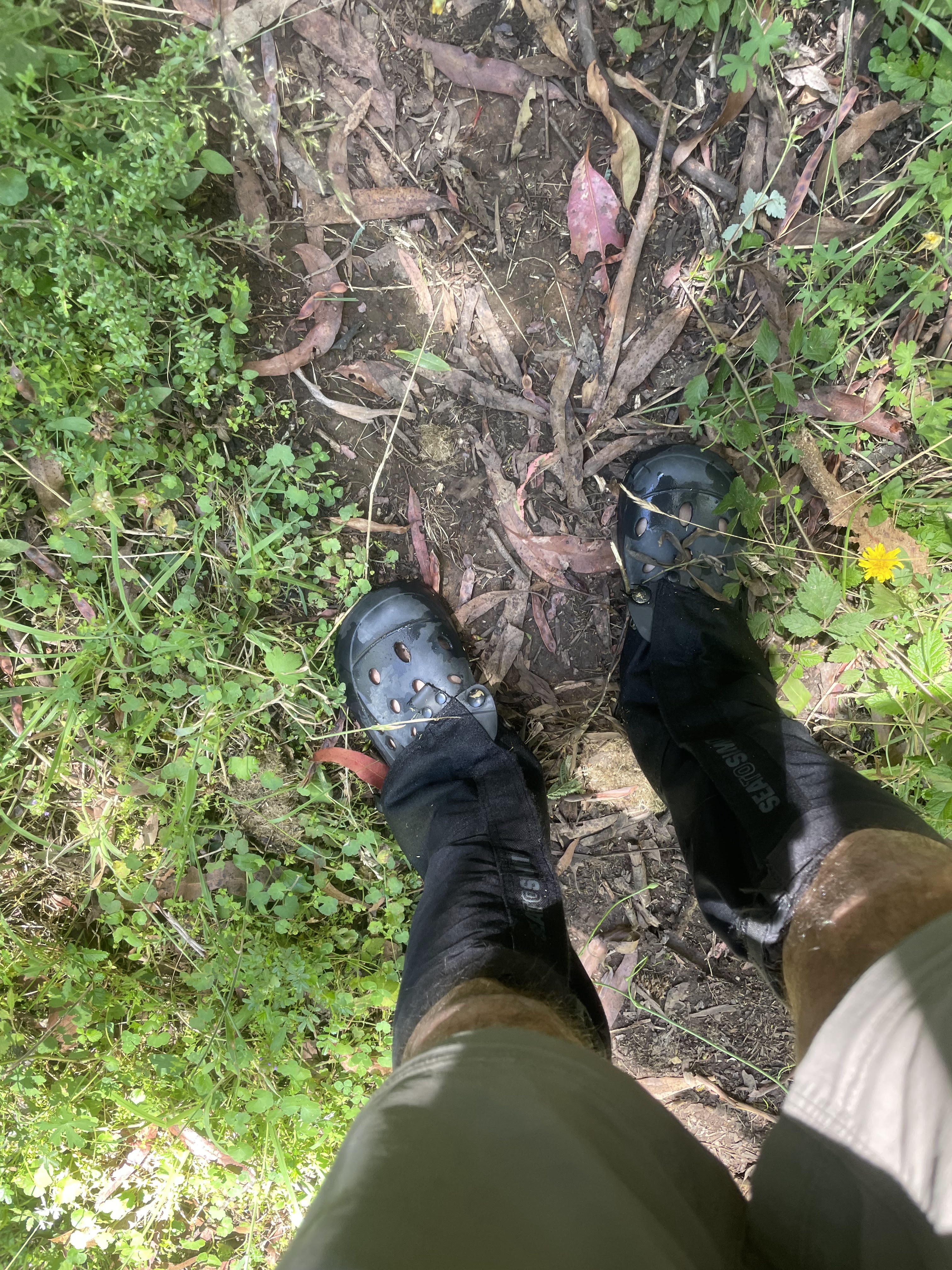


hiking crocs!


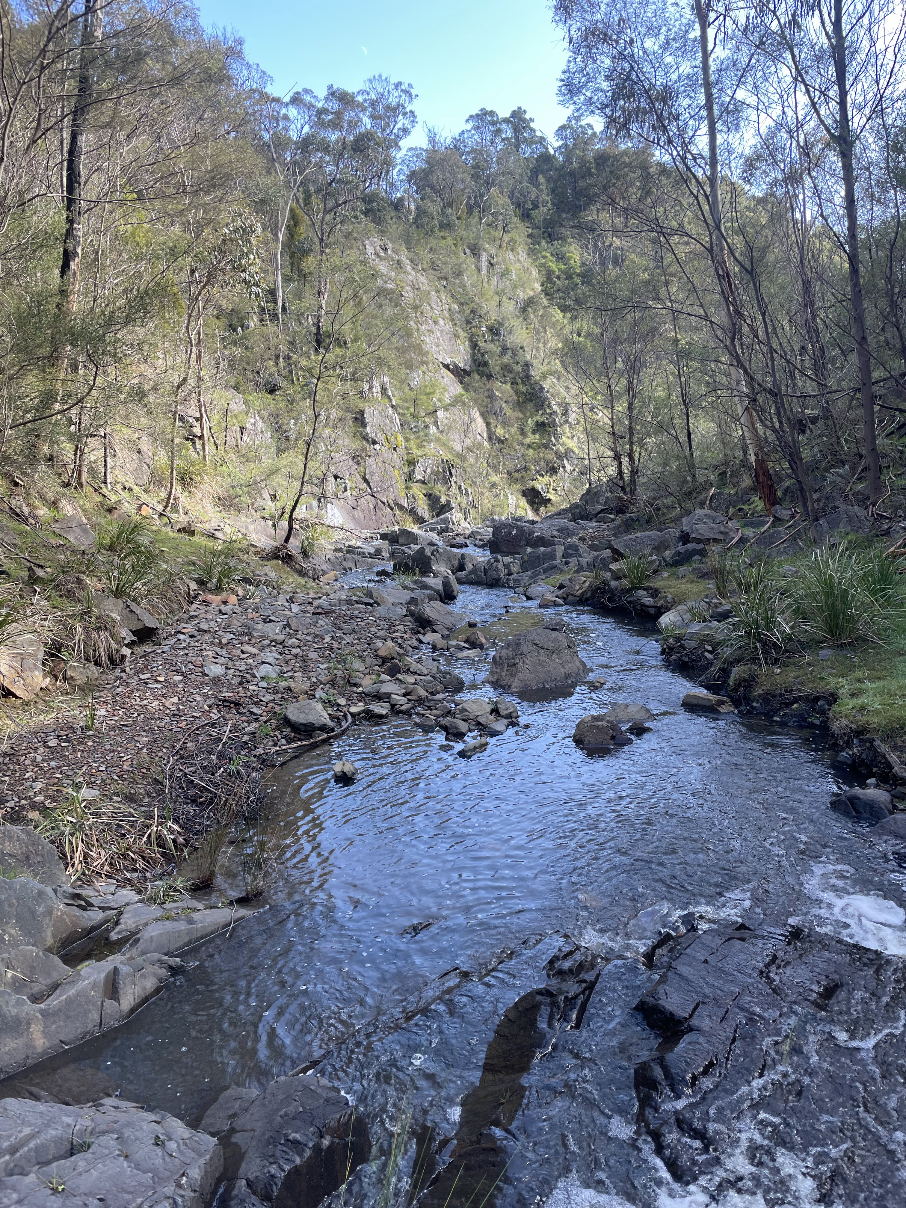
The planned route I chose was Stanley Name Spur to get up on the Crosscut and return on Monday via Howitt Spur.  The start of the walk crosses the Howqua River and runs parallel for the first 3 kms zig zagging six times to cross the river.
I chose to wear my camp shoes crocs for the remanding six crossings and walked with them to save time of changing between crossings, By the end of it I lost some skin on the insides of foot causing friction rubbery wet crocs ouch!....   snake count 1 copperhead & 1 Tiger snake.


Circuit Rd


With boots back on and 3 kms later I made it to the junction where it splits Queens Spur and Howitt Spur
I went left up the Queens as it will join up to SNS Spur further up, the sound of the river was fading the more I walked up and  coming to a section off blackberry bushes and lush fern gully to my right , luckily the Blackberrys were not covering the track too much looked like it had been cleared can only imagine by end of spring would be overgrown.


Reached Stanley Name Spur no problem turned right , its a gradual uphill ascent quite easy going.
I come out to a open clearing with views of Howitt Spur to my right and thru the trees view of the Crosscutsaw.  Now where is the track gone??... couldn't trace it on the clearing and ahead lay a big old fallen tree I figured the track is thru there or to the left but I didn't bother to check so I forged ahead to the right and into the dense head high scrub and had a 20 minute bush bash session,  also had a wrestle match with a trees branches inter twinned caught on top of my backpack, moving side to side and moving ahead was impossible it was like the tree was alive and slowly constricting my body just like the movie (Day of the Triffids) I shouted F!@#k You! and I broke free. come out of the bush to a steep rocky hill in front , the track is over on top so i scrambled up and found the trail


Day of the Triffids


Looking back at bush I popped out of & steep scramble up

Bush bash session


Now following a narrow spur I popped out to a clearing a great little camp spot with towering cliffs to one side , here another tent was setup of a young couple who had walked from Macalister Springs.
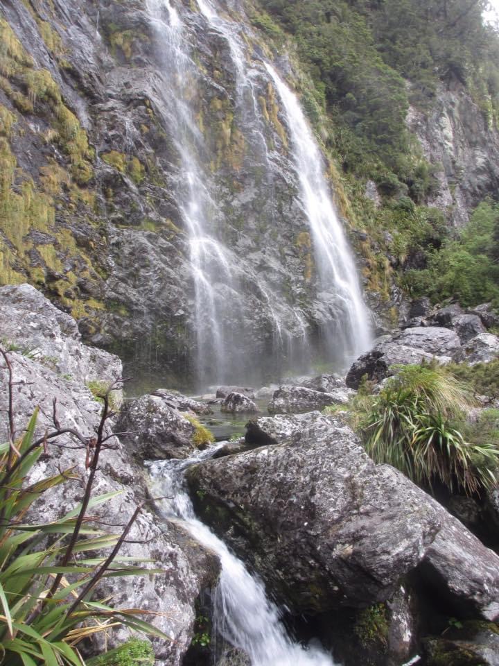
I went and refuelled on water by the creek and settled in for the evening , dinner was ravioli with Napoli sauce yum yum... I tried making light conversation with the couple but wasn't getting a positive vibe and interest in return maybe a Gen Z thing....... 


Had a crappy sleep I think due to a full moon was on and off I woke around 7 and lay there for another hour until the sound of march flies started buzzing around. Broke camp bit after nine and started the final steep ascent up to the Crosscut about 2 kms.  Sun was peaking thru the trees reflecting as I walked up to a near vertical rock band luckily there is some blue electrical tape on the branches indicating the route up. I stowed my poles on my pack to use my hands to scramble up in wet weather would be very sketchy,  walked another 300 meters to another rock band looking for some of the blue tape but none, so had a look at both sides for possible easiest ways up.
Once up on the second I  was relieved , the crosscut is so close now  was faced with another but large rockbound but impossible to go over I found a faint pad and some tracks that skirts to the left and onto the crosscut.

 1st rockband i scrambled up the middle


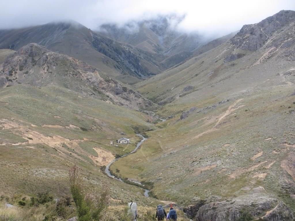
Now the plan for today was to head to Mt Buggery or Speculation , now out on the exposed crosscut the sun was warming up  I headed left towards Buggery views out to the east are awesome rolling hills to infinity and to the west also with Mt Stirling and Buller in the far distance. 
I filled my 4liter water bladder at camp and 2 bottles as there is no water along the way and a possible dry camp.  The walking is a bit of a slog as its quite rocky with the odd steep ups and downs and a blaring sun beating down I was overheating rapidly.
I stopped a few times for a break as I knew I had plenty of time in the day , was getting on 11 am and I was only about an hour and half from Buggery , i made my mind up I would go as far as this as was getting too hot , but I changed my mind thinking im going to be there all day doing nothing but beat off annoying March flies in the heat though there is tree cover there, and going further to Mt Spec another hour I decided I didn't want to be walking back in the heat tomorrow so headed back over to Howitt Spur and made the long descent back to Upper Howqua , was happy with my decision was back down by 6pm and made the long drive back to Melbourne. Had a mix of enjoyment & not,  the heat got to me I should of just gone to the beach!  Mt Spec  and Buggery will be there next time.


Friday 26 January 2024

Kayaking Studley Park January 2021


Maiden Voyage


Unlike the summer in Melbourne we experiencing  right now, coolish rainy days with odd hot day thrown in,  early 2021 was consistent  with warm hot days followed by balmy nights just how I like it.

Was bored one day sitting at home , too warm for cycling or hiking have watched a lot of people using stand up paddle boards and kayaks but wanted something I can store away in the cupboard and throw in the back of the car without the hassle of roof racks etc... 

So i googled and found this inflatable kayak in stock at BCF ( a bogans paradise for fishing hunting   etc.._.) "Boating Camping Fishing"

Anyway  quick ring around and the Maribyrnong store had one in stock so jumped in the car to go collect. Did a practice run on inflating it at home making sure I don't look like a clown in front of passers by at the river or even worse sink.

My housemates were impressed also with this inflatable vessel, after a successful test run I packed it up and hurried down to Studley Park on the Yarra to launch on its maiden voyage


Was early afternoon on a Saturday people were out in droves, picnicking , smell of cheap Bunnings sausages cooking on the barbi made me hungry and a few out on the water kayaking and stand up paddling.

Launched with no drama just was awkward hoping into the cockpit from launch pad , I tried to hide my awkwardness balancing act on one leg and the other foot on the seat kayak, but managed to get my arse on the seat without capsizing it, imagine that!

I paddled up stream with my boom speaker blaring out Chilli Peppers greatest hits , recorded myself on Strava app to see how many kms I would cover, I did a 180 and headed down river for Dight Falls and check it out from the water instead of the usual from the sidelines.

I got within 50 meters of the falls the force of the water started pulling me down at a rapid pace, I crapped my pants for a second and quickly turned around and got out of there.

Headed back to where I launched, deflated and headed home covered approx 2 kms, was a great afternoon and good purchase , have just recently ripped it out of storage after 3 years and using it on the odd warm day.


Back out after 3 years

Some Lotus leaves of some variety at Aura Vale Lake


Winter Sunrise July 2022


After spending half the year sitting on the beach sipping on Chang beer in Thailand, I was back in Melbourne for a visa update I had a short window of opportunity to fit in a snowshoe hike to Victoria second highest mountain Mt Feathertop.
Forecast was looking great crisp blue skies no wind so jumped in the car and headed up for a quick overnighter and a welcome home sunrise.

Its a straight forward hike up Bungalow Spur well maintained so there is no getting lost nonsense or losing the track unless your name is Stevie Wonder.
Its approx 12 kms from the bottom to summit of Feathertop, a lot of badass backcountry skiers make the pilgrimage up for some untouched back country turns, avoiding the over crowded resorts and expensive lift price tickets, 
 
After pitching my blue Macpac Minaret tent on a knoll overlooking the razorback and southern slopes of Feathertop I headed for a stroll up Little Feathertop where best views in the house are in my opinion.


Little Feathertop looking west sunset


Was hoping to get a killer sunset from Little Feathertop as seen above from a previous trip circa '16

but oh well next time, I stomped back to my my tent on the knoll and tucked into dinner in the fading light and settled in for the night. And one thing to confess here is I was too lazy to prepare my usual dinners of stirfry veg or pastas I elected by lowering myself to buy one of those pre dehydrated meals in a bag you add water to and self cooks into prison slop and looks like a post bing drink vomit. I did regret it after each mouthful.

View south of razorback

Northwards- Little Feathertop top left with Feathertop middle back


Morning arrived with a stunner sunrise and a hot tea to take it in perfect!

I packed up shortly after and started the long descent to the car and long drive back to Melbourne.


Yep got my hat on wrong way


Strath Creek Diggers Gully Circuit Day Walk - September 2023


Strath Falls where you cross & head up the the spur to the left

DELWP do not recommend this walk as it is is both remote and dangerous. Search and Rescue Police have requested that this trail be closed due to the numerous rescue operations to extract (at tax payers expense) inexperienced hikers who have either been injured or lost on the hike. As with all hikes, you need to ensure that you have the necessary gear, navigation skills and the experience to navigate the trail and return safety under your own steam. If you are uncertain about any hike then do not undertake it and never overestimate your abilities.


Ignoring all the above warnings I jumped in my trusty VW van and set out to Mt Disappointment State Forest, was a coolish morning with forecast tops in the late teens with partly cloud cover I thought perfect hiking weather. My VW van had almost disappointed the day , power cut out forcing me to pull over and restart the engine as there is a glitch with one of the sensors causing the turbo to switch off , has happened a hand full of time now , restarting it always fixes the turbo but this morning it killed my battery, I waved down a passing car and surprisingly stopped and had jumper leads to get me going again phew! An older couple heading back to Wagga Wagga after spending the weekend in Melbourne for a wedding thanks for saving my day!

I arrived at the car park which sits a few hundred meters from the falls lookout point.

Strapped my day pack on and off I walked down to the fenced lookout, ignoring the recommendation by DELWP sorry to disappoint you.....  I walked down the gully passed a gap thru the fence and picked my line down the vertical drop to the top of Strath Falls. This circuit is part off trail and intersects some 4wd trails so a bit of a mix bag.


Top of Strath Falls


After crossing the creek I heading east up the ridge, was expecting the walk up the spur to be more dense bush but was somewhat not an ordeal as expected,  I got about 700 meters to the top and popped out onto a 4wd trail and chucked a lefty and followed it for about 3ish kms, am not a fan of walking 4wd trails so the 3kms was little tedious but was happy to reach the point after checking the handy gps app "Terra Map" that the road bash would finish and I will head down hill off trail again to Diggers Gully 

The hike down was steep and steep and at one point I was bum sliding on loose rock as it was too sketchy to try and do a fast action Bear Grylls style slide on one leg to another, sorry mate not today, no energy I didn't drink the blood from the dead kangaroo i saw earlier.  Finally I reached Diggers Gully beautiful spot for a snack and break.


Diggers Gully Creek

Enroute to Diggers Gully

After a snack I zig zagged my way across the creek and sometimes walking along the sides the walking was great to the sound of the creek trickling away , after about 3 kms I reached a dead end and ascended up a spur which intersects back on the 4wd trail.  Was feeling a little tired but happy with the walk so far, dark clouds rolled in and started to rain, was deciding wether to continue on with the route or just call it a day and walk back on the 4wd trail the quick way back to the car, or head into the gully of Strath creek and head upstream to the falls back to car.

I called it a day and figure ill come back another day and complete it, a great day walk by the way did not DISAPPOINT..


Photo Blog NZ

 Thought ild share some images of various tramping trips from across the ditch in beautiful South Island New Zealand ranging from 2013 & 2016, as I wouldn't be able to do a detailed blog of the trips as my memory would not allow me. The snowboarding/ski is great too in winter.


Canterbury

Lake Mckenzie


Green Lake Hut


Mitre`Peak


Ohau Ranges


Somewhere on the Routeburn


Harris Saddle 


Lake Mckenzie

Kea


Routeburn 


Mt Nelse September 2023

The 2023 Australian snow season in particular Victoria was below average with ski resorts closing weeks ahead of usual end times. I had mana...